
Punta Alegre Fm
Type Locality and Naming
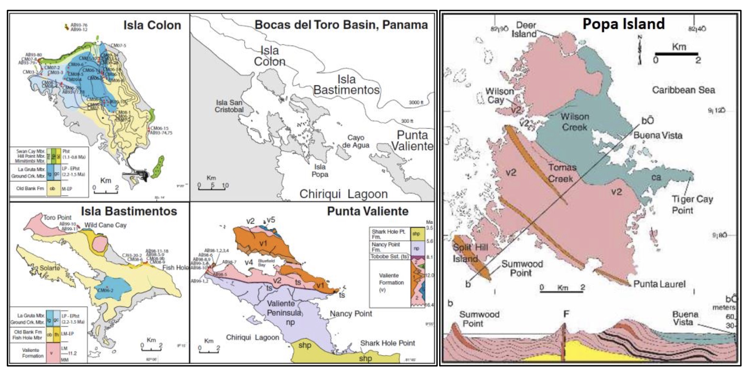
[Figure 1. Bocas del Toro archipelago, NW Panama with map of the western & central portion together with the geological maps of Isla Colon, Isla Bastimentos, Punta Valiente (Klaus et al. (2012)) and Popa Island (Coates et al. (2005)). Section (b-b’) over Popa Island shows the Valiente Fm where it is unconformably overlain by the Pliocene Cayo Agua Fm. On Popa Island, only the v1 basalt flow facies and the v2 coarse volcaniclastic facies (see Figure 043) (not associated with reef lenses) are present, with thin layers of low rank coal, an example of which is exposed along the coast immediately north of Punta Laurel. A prominent basalt dike is exposed at the tip of the Punta Laurel where it cuts the Valiente Fm.]
Synonym:
Lithology and Thickness
Thickness: The formation is 19 m thick at the type locality.
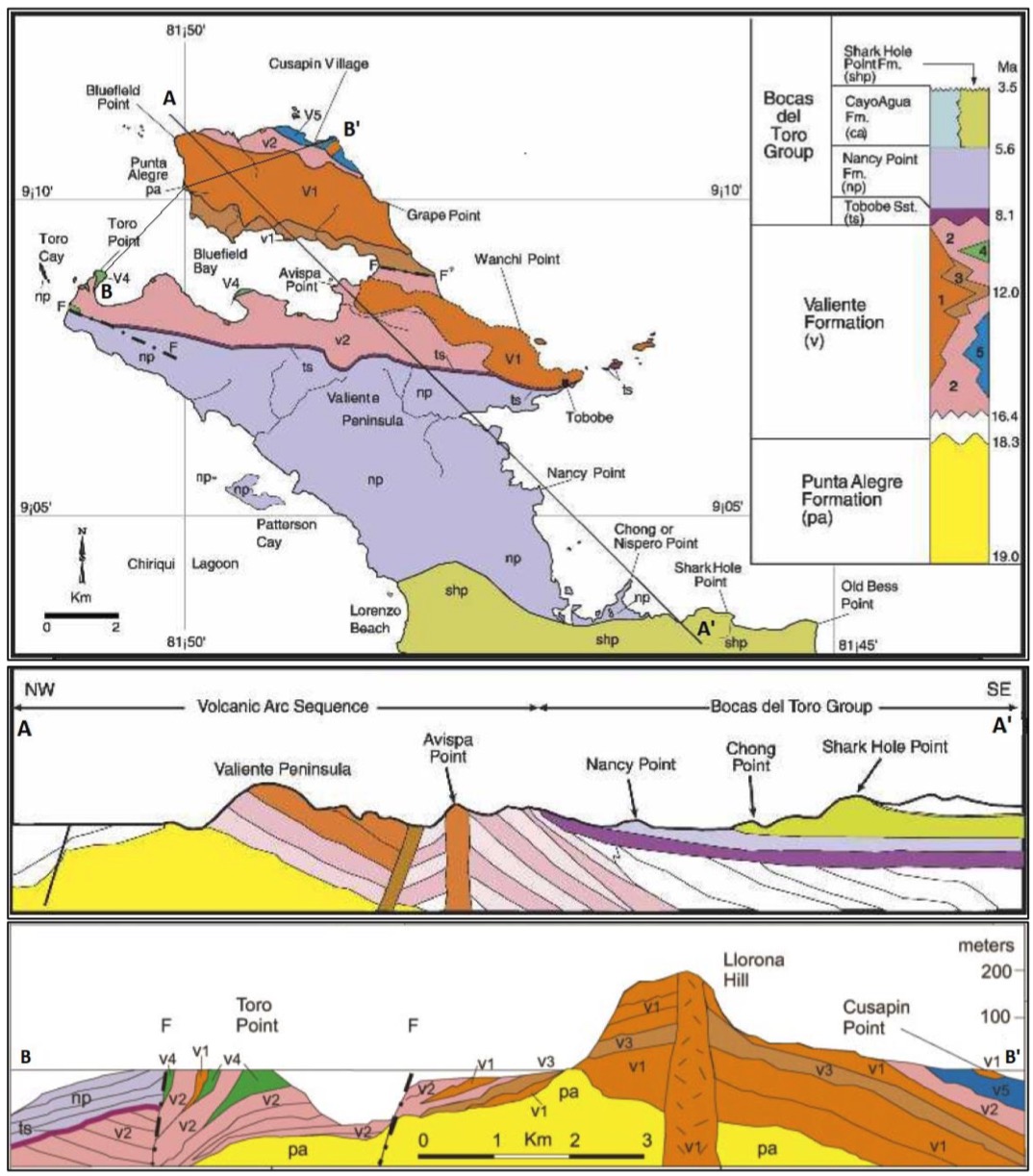
[Figure 2. Coates et al. (2003 & 2005)’s description of the geological map and cross sections (A-A’ and B-B’) of the Valiente Peninsula (Punta Valiente) showing the distribution of the Punta Alegre Fm and Valiente Fm and the Bocas Del Toro Gr. The five lithofacies of the Valiente Fm are indicated by separate colors and numbers on the key (upper right) as follows; v1) basalt lava and flow breccia facies; v2) coarse volcaniclastic facies; v3) pyroclastic facies; v4) coral reef facies; v5) marine debris flow and turbidite facies.]
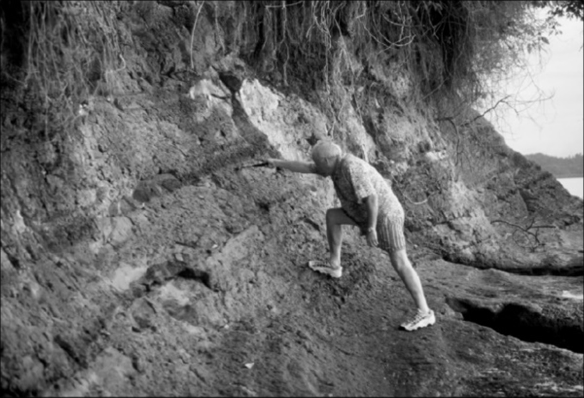
[Figure 3. Stratotype of the Punta Alegre Fm, 1 km south of Bluefield Point, Valiente Peninsula, Bocas del Toro (Figure 043; Figure 042). Possible bentonite appears as a dark horizon above the hammer. Coates et al. (2003).]
Relationships and Distribution
Lower contact
Upper contact
Regional extent
GeoJSON
Fossils
Age
Depositional setting
Additional Information
References: Coates et al. (2003); Coates et al. (2005).